NEWER UPDATE – SEPTEMBER 20, 2020 Evening Update can be found here: “Bobcat Fire (9/20/20) Evening Update; Another Day of Fireline Containment and Water Drops“
NOTE: NewsPlus will plan on posting two updates an AM and PM update to our website and more if needed. Please follow our Facebook page for any timely updates throughout the day.
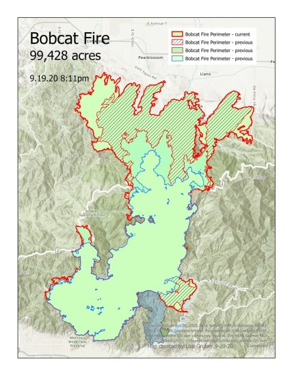
SEPTEMBER 20, 2020 – BOBCAT FIRE MORNING UPDATE 10:00 AM: The Bobcat fire has now burned 99,428 acres, burning almost 8500 acres since yesterday morning and remains at 15% containment.
Currently, as of 10:00 am it air operations look to begin shortly. A spotter plane has made several passes over the active areas of the fire possibly surveying potential drop locations. Helicopters are working along Big Pines Highway, Largo Vista Road and along Pinyon Ridge on the east. One chopper is currently working to the south and southeast of Littlerock Reservoir. As of 11:15 am air attacks have begun on the east end of the fire.
From Incident Command: “Today’s priorities are to continue work on the control lines. These lines are being built in the northeastern and northwester portions of the fire in order to stop the forward progression. Additionally, firefighters will continue to mop up and secure the areas around structures where the fire burned into the Antelope Valley and Juniper Hills. We will also be looking for ways to secure the line between Mt. Wilson and Highway 2 to eliminate the threat to that area.”
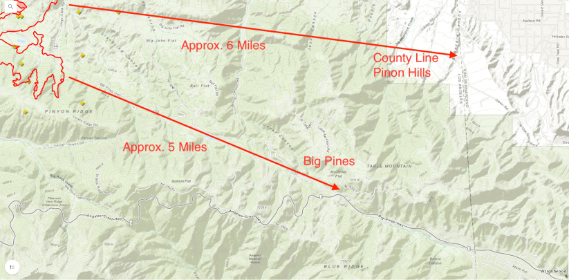
The fire seems to be creeping closer to Big Pines but is still holding around Largo Vista Road. However, it pushed south up the canyon towards Pinyon Ridge about 5 miles from Big Pines. The west end of the fire saw significant growth pushing west towards Littlerock Reservoir heading towards Mount Emma and about two miles from Mt. Emma Road to the north.
Evacuations Orders and Warnings have not changes since last night, at least as of 10:00am today.
Here is a map created by Lisa Gruber that shows each days fire the growth since 9/16.
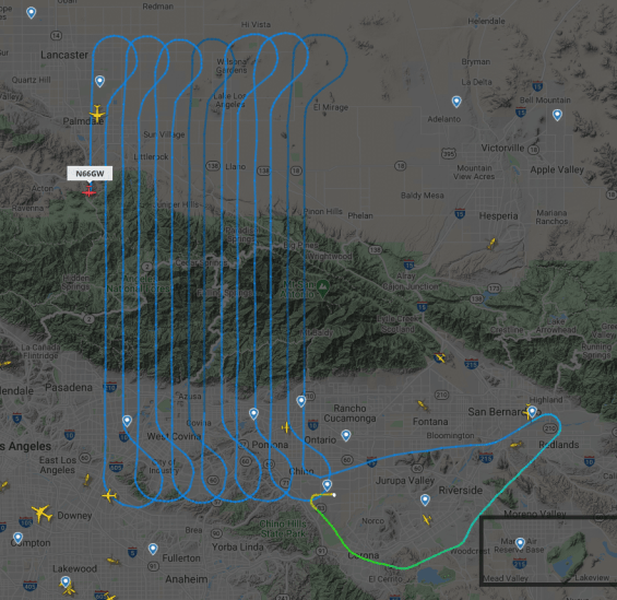
Each night a specialized plane flies over the fire making an infrared scan to aid in accurate mapping of the fire and to show where the active parts of the fire are. The map below show the flight path that the plane made last night.