NEWER UPDATE – SEPTEMBER 20, 2020 Morning Update can be found here: “Bobcat Fire (9/20/20) Morning Update; Maps & 100K Burned“
NOTE: NewsPlus will plan on posting two updates an AM and PM update to our website and more if needed. Please follow our Facebook page for any timely updates throughout the day.
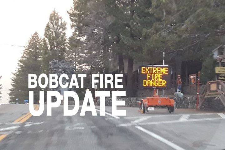
SEPTEMBER 19, 2020 – BOBCAT FIRE EVENING UPDATE 10:00 PM: The Bobcat fire has now burned 93,842 acres, burning almost 3000 acres today, this acreage will likely increase after thermal imaging of the fire is completed overnight. The fire remains at 15% containment.
Today was a very different day compared to yesterday. Starting early in the morning it was clear that it was going to be an air war. Several air tankers throughout the day were laying fire retardant lines near Juniper Hills, Little Rock Reservoir, and the Pearblossom area on the west end of the fire and along the eastern front of the fire near Largo Vista, Mile High, Big Pines Highway area. At times, over Phelan, there were several aircraft circling awaiting instructions from the lead aircraft, then following it on a run into the fire area. It was a strange sight to see a DC-10 Jet Tanker flying what seemed several hundred feet off the ground across the foothills of our local mountains.
On the ground, there was heavy fire activity crews on both sides of the fire were working on constructing indirect fire lines, structure protection, mop-up, and eliminating unburned “islands” left from yesterday’s 30,000 acre hard run onto the desert floor.
On the Antelope Valley side the fire pushed toward Little Rock Reservoir, Mt. Emma, and down towards Pearblossom and Littlerock. this caused a new evacuation warning to be issued from south of Pearblossom Highway, east and north of Angeles Forest Highway, north and west of Mt. Emma Rd., east and south of Highway 122, and West of Cheseboro Road.
On the Pinon Hills/Wrightwood side of the fire dozers were working near Grassy Hollow on Highway 2 and on Big Pines Highway near Camp Elk. A dozer line is also being constructed starting at Camp Singing Pines and heading north. Crews were working hard to build these containment lines and fire retardant lines in preparation should the fire make a run towards Pinion Hills or Wrightwood. The fire pushed to the east from Big Rock Creek and Valyermo towards Largo Vista Rd (N4). Crews took a stand along N4 but the fire jumped the road which caused a mandatory evacuation for the south of Highway 138, north of Big Pine Highway/Highway 2, west of 263rd East (County Line), and East of Largo Vista Rd. Edison was asked to shut off power to the area but could only partially shut off power due to the possibility of losing water pressure. Power was shot off along Largo Vista Rd and along Big Pines Highway East for about 1 1/4 miles. San Bernardino County Fire deployed a Type III & a Type VI strike Team (10 Engines, 2 Batallion Chiefs) to the Bobcat Fire. Type II strike teams are brush engines and Type VI are brush patrols with thermo gel used to pretreat homes. One of their first missions was to eliminate an unburned island near the Valyermo Fire Station.
It was reported today that the St. Andrews Abby near Velyermo was saved and the Monks are all safe. However, the Nature Center at Devil’s Punchbowl was burned to the ground. The staff building and other structures were still intact.
It was cooler today than yesterday with gusty southwestern up-canyon winds gusting between 20 and 20 mph. Little change is expected for tonight. Sunday will see drier air moving into the area which will result in lower relative humidity. Weak southerly down-canyon winds are expected tonight with southwesterly up-canyon winds on Sunday.
Incident Command is planning to continue direct and indirect line construction with resources available utilizing pre-existing dozer lines when possible and provide structure protection when the fire impacts communities. They have projected that the “Fire will continue to spread from the foothills into communities of Juniper Hills, Valyermo, and Big Pine. Wind-driven fire will spread downslope with spotting and rapid growth threatening structures. The communities of Littlerock and Wrightwood will be impacted soon. On the east side,
the fire continues to threaten containment lines north of the Ranch 2 fire and threatens the Hwy 39 corridor. Very poor humidity recovery, especially in higher elevation, and warm overnight temperatures will allow the fire to burn actively through the night. Fire activity on the eastside of Mt. Wilson Observatory is threatening all of the values on that peak.”
Evacuation warnings were lifted for Arcadia, Sierra Madre, Monrovia, Duarte, and Bradbury. Mandatory evacuations are still in place for the following areas:
- South of 138th St East, North of Big Pines Hwy & Hwy 2, West of 263rd East, East of Largo Vista Rd.
- North of Angeles Crest North and between Clear Creek Station and Hwy 39.
- East of Devils Punchbowl Rd, South of Big Pines Hwy, North of Big Rock Creek, & West of Jackson Lake.
- Aqueduct: South of Pearblossom Hwy (SR138), North of Big Pines, East of 165th, and West of Largo Vista Rd.
- Ward: North of Fort Tejon Rd, South of Avenue V, East of 87th E., West of 121 St E.
- Longview: South of Avenue 12, North of Aqueduct, West of 165 St E and East of 121 St E.
- Tejon: South of Fort Tejon Rd, North of Cooley Place, East of 89th St. E. and West of Longview Rd.
- Peach: North of Pallett Creek, South of W. 114th St., East of Longview Rd, and West of 165th St.
- Cima Block: 96th east to 116th St. E/Fort Tejon Rd south to SR 2.
- Juniper Block: 116th E to Devis Punchbowl Rd / Fort Tejor Rd to SR 2.
- Punchbowl Block: Devils Punchbowl Rd to and including Fenner Camp.
- Paradise Block: Fenner Camp to the intersection of SR 2 and Big Pines.
- Chilao, the CalTrans Yard, the 3 Points area and the Angeles Crest Christian Camp were all issued Evacuation
- Orders. Crystal Lake area remains under the Evacuation Order.
Evacuation Warnings remain in effect for the communities of Wrightwood, Pinon Hills, Altadena, and Pasadena.