NOTE: NewsPlus will plan on posting two updates an AM and PM update to our website and more if needed. Please follow our Facebook page for any timely updates throughout the day.
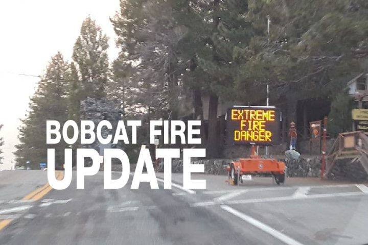
SEPTEMBER 23, 2020 – BOBCAT FIRE Evening UPDATE 8:00 PM: The Bobcat fire has now burned 113,733 acres, burning almost 450 acres today and has grown to 39% containment. There is 1,613 personnel on the fire, 170 engines, 25 hand crews, 11 helicopters, 23 dozers, 10 water tenders, and numerous aircraft working on this fire today.
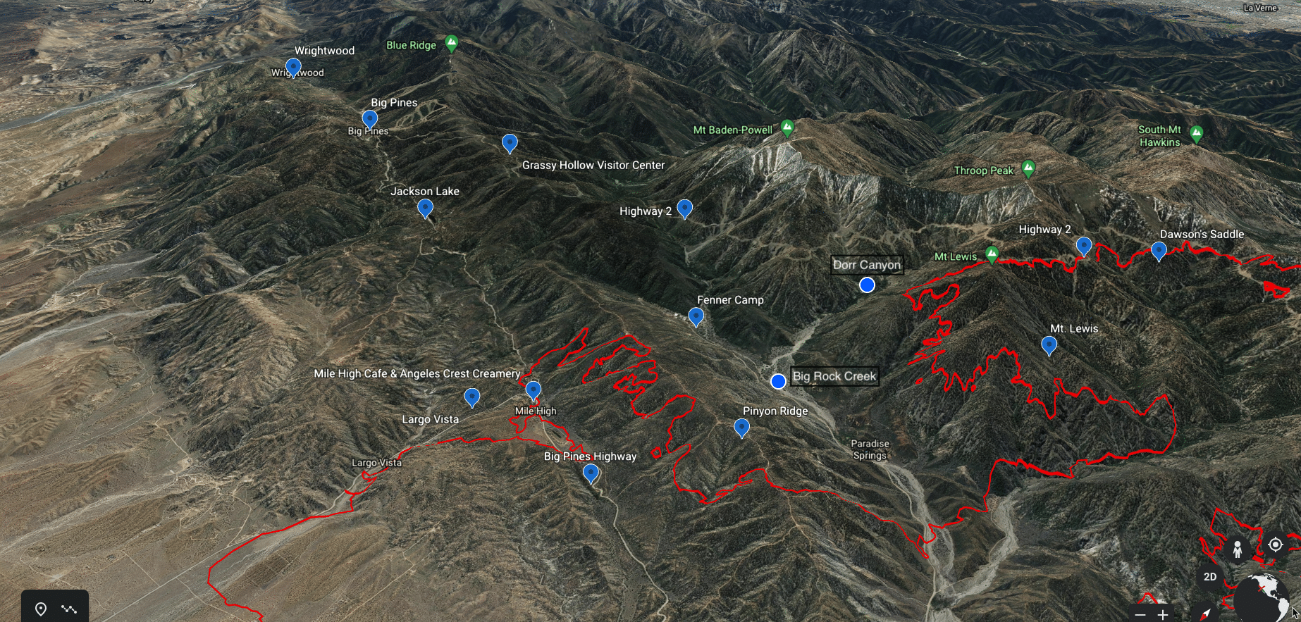
There is not much to report on today, crews continued to construct indirect and direct fire lines by hand and by dozer around the Bobcat Fire “usual suspects.” Pinyon Ridge, Mt. Lewis, and Dawson’s Saddle had a lot of attention today not only from choppers dropping water all day but from crews working hard to stop the forward movement of the fire into the Sheep Mountain Wilderness and pushing closer to Wrightwood. Is there any water left in Jackson Lake? Containment lines were increased along the north side of the fire in the Pearblossom/Juniper Hills area. Crews are continuing to patrol and mop-up along the containment lines. Crews were also patrolling and moping up from Devil’s Punchbowl to Pinyon Ridge. Crews in the Big Rock Creek spent the day prepping and constructed a handline with hose lay down to Highway 2. There was fire activity on Mt. Lewis in Dorr Canyon, flames and smoke could be seen. Patrols also traveled along Highway 2 near Dawson’s Saddle to Highway 39 with no additional growth from the fire. All in all, today was about Highway 2 from Mt. Wilson to Big Pines.
Several evacuations orders were lifted and changed to warnings across the Antelope Valley including the area west of 263rd St., North of Big Pines Highway/Highway 2, south of Highway 138, and east of Largo Vista. Good news for the folks in Pinon Hills as it shows that the containment lines are holding and the threat is lowering. San Bernardino County originally issued the Evacuation Warning for Pinon Hills and they will be the ones to decide when it should end. At present, the warning stands and serves as a reminder to stay vigilant and ready to act should the Bobcat Fire rear is ugly head in their direction.
Here is what Incident Command had to say in their evening report. Today “much of the work was focused on completing the strategic defensive firing operation from last night [in the Mt. Wilson area]. Crews searched any remaining unburnt fuels and brought the containment line to HWY-2. Additionally, operations officials flew the fire near the 2009 Station Fire burn scar looking for any potential areas of concern, however, they were able to construct a handline directly near Red Box Picnic Area. Meanwhile, firefighters continued to patrol and monitor the containment lines near the foothill communities finding mostly cold containment lines.
Tonight Crews “will continue to fortify the areas that were strategically burned to improve containment while continued patrols and mop-up on hotspots near the fire line. There may be additional strategic burning in areas where the fire continues to push North, East, and to the West. Personnel will be holding the portion of the line in the Northeast and Big Rock Creek and monitor and patrol the area from Big Rock Creek all the way south back to Mt Wilson. Structural engines continued to secure areas around structures. Dozers and hand crew will work through the evening completing handlines on direct and indirect lines in both the West and Eastern portions of the fireline,” stated Incident Command in their evening update.
As for weather, Incident Command is predicting for tonight, Friday, and Saturday to be warm and dry. A high-pressure system will come into place in the next couple of days with above-average temperatures and very low relative humidity expected and the possibility of breezy northeast to easterly winds commonly known as Santa Ana winds.
The fire season has only just begun, the Santa Ana’s haven’t officially started yet. A wildfire could erupt at any moment, so please, as they say, “keep an eye out” and know what to do if it happens near you. Successfully preparing for a wildfire requires you to take personal responsibility for protecting yourself, your family, and your property. Visit the SBC Fire website for more information about how you can be prepared. All San Bernardino County residents are encouraged to sign up for the TENS alert system to get notifications via phone/text or to download the Ready SB App.
The big media seems to be shifting focus to how the Bobcat Fire started, many speculating that it was SCE Edison and how resources were utilized in the first few days of the fire. “This fire ain’t over yet.” So, NewsPlus is going to focus on the information you need to know to keep you and your families safe until this fire is over. One of the nice things about a local newspaper, like NewsPlus, is we understand the community, the area, and what the Tri-Community wants or needs to know especially in times of crises and disasters. You can’t get local specific information from the networks or even the regional media outlets. Local media fills a great need in local communities and all of us at NewsPlus strive every day to inform you about what’s happening in the Tri-Community. Thank you for all of the “atta’ boys” and well wishes that have come our way for our work during the Bobcat Fire. However, it is the brave firefighters that are out there working long hard hours to preserve our forests and protect our lives and homes that deserve our thanks. THANK YOU!
Evacuation Orders:
- South and West of Upper Big Tujunga.
- East of Angeles Forest Hwy.
- North of Angeles Crest Hwy.
- Residences along Angeles Crest Highway, between Angeles Forest Highway and Highway 39.
- The unincorporated areas of Juniper Hills, Devils Punch Bowl, and Paradise Springs.
- The unincorporated areas of Crystal Lake, East Fork of the San Gabriel River, and Camp Williams.
- South of Hwy 138, North of Big Rock Creek, East of 87th St East, and West of Largo Vista Rd.
Evacuation Warnings:
- City of Pasadena
- Unincorporated communities of Altadena, Pinon Hills, and Wrightwood.
- South of Pearblossom Hwy, East and North of Angeles Forest Hwy, North and West of Mt. Emma Rd., East and South of Hwy 122, and West of Cheseboro Rd.
- South of Hwy 2, North of Blue Ridge Truck Trail, East of Hwy 39, and West of the Los Angeles Co. border.
- South of Ave U-8, North of East Ave W-14, East of 121st East, and West of 155th St East. (Longview)
- South of Pearblossom Hwy (Hwy 138), South and East of Pearblossom Hwy (Hwy 122), North and West of Mt. Emma Rd., North and East of Angeles Forest Hwy, and West of Cheseboro Rd. (Emma)
- South of Mt. Emma Rd., North of Upper Big Tujunga Canyon Rd., East of Angeles Forest Highway, and West of Pacifico Mountain
- Littlerock: East of Cheseboro Road, South of Pearblossom Hwy, North of Weber Ranch Rd, West of 87th St E.
- South of 138th St. East, North of Big Pine Hwy and Hwy 2, East of Largo Vista Rd., and West of 263rd St. East.
- South of Hwy 138, North of East Ave W-14, East of 155th St East, and West of 165th St. East.
- North of Tejon Road, south of east Ave V, east of 87th St East, west 121 St East.