NOTE: NewsPlus will plan on posting two updates an AM and PM update to our website and more if needed. Please follow our Facebook page for any timely updates throughout the day.
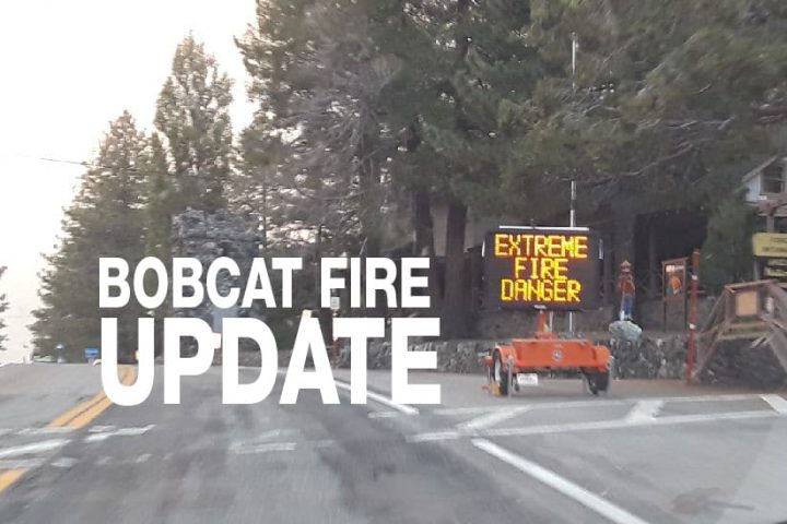
SEPTEMBER 24, 2020 – BOBCAT FIRE Morning UPDATE 10:00 AM: The Bobcat fire has now burned 113,986 acres, burning almost 700 acres today and is now at 50% containment.
Significant progress was made last night, firefighters were able to increase containment to 50%. The Bobcat Fire grew by only about 700 acres since yesterday. The fire made minimal progress on Pinyon Ridge. On the east side of the Ridge, crews have constructed a dozer line up from Big Pines Highway and across the ridge to box the fire in. Additionally, they have a constructed handline around the perimeter of the fire on Pinyon Ridge on the eastern portion. Several contingency lines have also been constructed in the area, including one from the Jackson Flat area north. The fire on Mt. Lewis has also crept down towards Dorr Canyon which is between Mt. Lewis and Mt. Baden Powell.
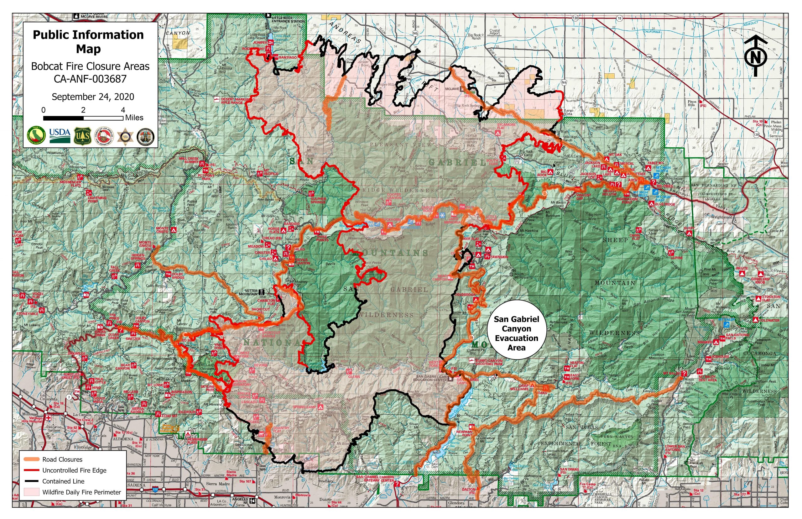
Because of the progress made in containing this fire, at 7:00 am this morning a repopulation order is issued lifting evacuation orders to “No Restrictions” for some areas in the Antelope Valley. Crews will be working to fully control the fire and they are continuing to evaluate areas for future repopulation. Livestock and animals are allowed to repopulate as well. Those areas are:
1) The Clear Area – North of East Avenue w-14, South of Pearblossom Highway, East of 155th Street East, and West of 165th Street East
2) The Sand Area – North of Big Pine Highway and Highway 2, South of Highway 138, East of Largo Vista Road, and West of 263rd Street. The southwestern region of the Sand Area may have power outages.
3) North of Fort Tejon Road, South of East Avenue V, East of 87fth Street East, and West of 121st Street East.
Today the priority will again be on the northeastern side of the fire from Highway 2 to Big Rock Creek Road. Crews will continue to construct direct handline. If they are unable to do so, they will prepare for a strategic firing to stop the forward movement of the fire. On the northwest side, crews are working to finish a direct handline from Highway 2 to Little Rock Reservoir. The country in that area is very steep and it is expected to take several days to complete. According to San Bernardino County, Fire crews will also be working on a contingency line near Blue Ridge/Inspiration Point in case the fire continues to burn to the east over Baden Powell and towards Wrightwood. They stressed that this is just a contingency plan.
Incident Command is predicting the weather “will be similar to yesterday, with light winds and humidity in the teens. High pressure will move in on Friday, starting a significant warming and drying trend. There will be near-record temperatures and very low humidity and on Saturday there will be the possibility of gusty northeast winds.”
The fire season has only just begun, the Santa Ana’s haven’t officially started yet. A wildfire could erupt at any moment, so please, as they say, “keep an eye out” and know what to do if it happens near you. Successfully preparing for a wildfire requires you to take personal responsibility for protecting yourself, your family, and your property. Visit the SBC Fire website for more information about how you can be prepared. All San Bernardino County residents are encouraged to sign up for the TENS alert system to get notifications via phone/text or to download the Ready SB App.
Evacuation Orders:
- South and West of Upper Big Tujunga.
- East of Angeles Forest Hwy.
- North of Angeles Crest Hwy.
- Residences along Angeles Crest Highway, between Angeles Forest Highway and Highway 39. – The unincorporated areas of Juniper Hills, Devils Punch Bowl, and Paradise Springs.
- The unincorporated areas of Crystal Lake, East Fork of the San Gabriel River, and Camp Williams.
- South of Hwy 138, North of Big Rock Creek, East of 87th St East, and West of Largo Vista Rd.
- South of 138th St. East, North of Big Pine Hwy and Hwy 2, East of Largo Vista Rd., and West of 263rd St. East. – South of Hwy 138, North of East Ave W-14, East of 155th St East, and West of 165th St. East.
Evacuation Warnings:
- City of Pasadena
- Unincorporated communities of Altadena, Pinon Hills, and Wrightwood.
- South of Pearblossom Hwy, East and North of Angeles Forest Hwy, North and West of Mt. Emma Rd., East and South of Hwy 122, and West of Cheseboro Rd.
- South of Hwy 2, North of Blue Ridge Truck Trail, East of Hwy 39, and West of the Los Angeles Co. border.
- South of Ave U-8, North of East Ave W-14, East of 121st East, and West of 155th St East. (Longview)
- South of Pearblossom Hwy (Hwy 138), South and East of Pearblossom Hwy (Hwy 122), North and West of Mt. Emma Rd., North and East of Angeles Forest Hwy, and West of Cheseboro Rd. (Emma)
- South of Mt. Emma Rd., North of Upper Big Tujunga Canyon Rd., East of Angeles Forest Highway, and West of Pacifico Mountain
- Littlerock: East of Cheseboro Road, South of Pearblossom Hwy, North of Weber Ranch Rd, West of 87th St E.