I was able to take a drive around Lone Pine Canyon and Wrightwood the morning of September 16, 2024, six days after the Bridge Fire raged through the area. Traveling from Phelan down Highway 138 toward Lone Pine Canyon Road, West Cajon looked normal. It was strange not seeing any traffic on the highway. I followed several engines heading toward the I-15. Traveling up Lone Pine Canyon, I could see several dozer lines and a few crews heading into the forest toward Lytle Creek to cut more line. I didn’t see any signs of fire activity or burned areas.
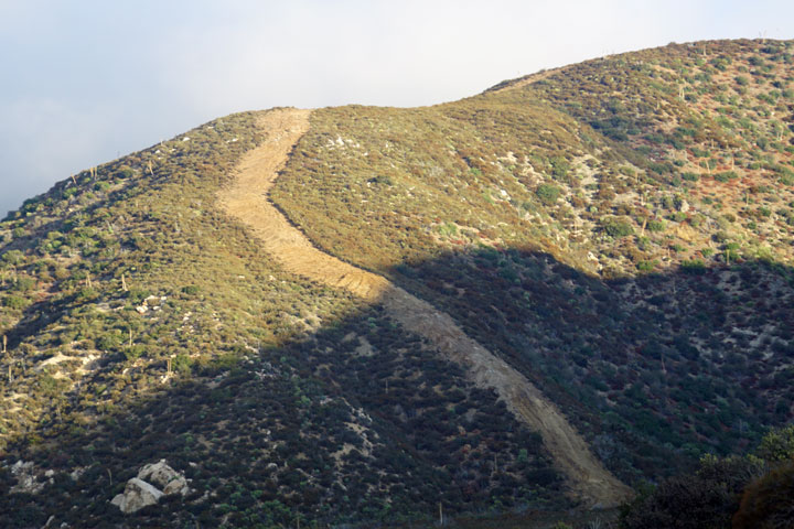

As I crested Lone Pine Canyon Road into Wrightwood, I could see the first images of the fire’s path. Such an odd sight to see the barren, ash-covered landscape across the valley on the south slope of Table Mountain. Heading up East Canyon and Mojave Scenic Drive, I could see no immediate burned areas, though I could see where the fire had approached the ridge near Wright Mountain.
As I made my way west, from Blackbird to Oak and over Linet toward the Methodist Camp, I could see where the fire had come down the slope, nearing town. I noticed a few small columns of smoke rising from above, probably from a stump or tree that had been smoldering and then caught the wind just right and sparked up. Concerning, but only for a few moments as I continued down the road and saw an Angeles National Forest engine pass by, heading up to monitor the situation.
As I passed the Country Club and over to Cedar, I stumbled upon a Cal Fire engine at the intersection of Twin Lakes. The younger firefighters had been sent up the mountain to dispatch the fire that I had spotted. I was relieved to see several engines patrolling around as well as a few law enforcement vehicles.
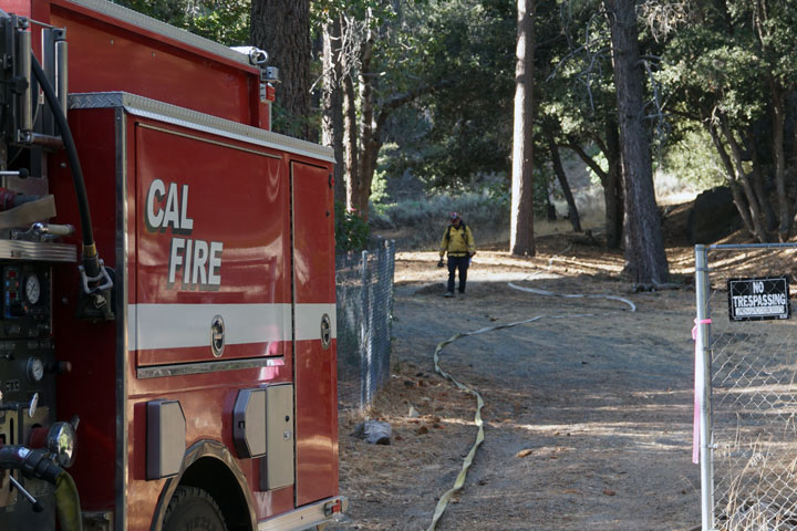
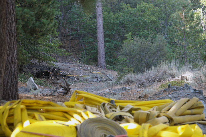
As I continued across Twin Lakes, I was beginning to see evidence of firefighting, coming across a pile of unfurled hose with a line or two heading off into the forest. Unknown to me until I returned home to view a map, the fire had burned down to just over the rise where I was standing. It was reassuring to see plans in action as firefighters had picked this location to make preparations for a potential firefight, more likely to lay containment lines to close off the fire from reaching town.
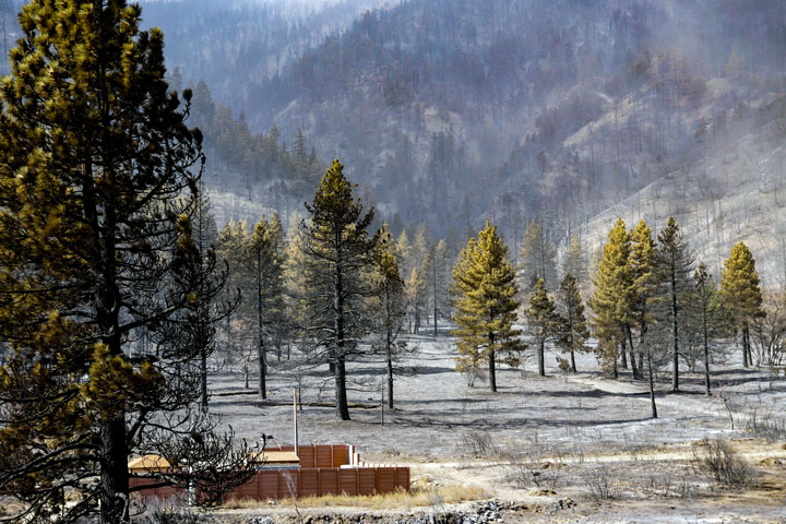
Further down the road on Acorn, I could see where the fire came down the slope, the gray ash-covered mountainside contrasting with the green and brown hues of the trees surrounding the homes on the street.

Somehow, a burned log had landed in the middle of a driveway. I could not tell how it got there, but it was a stark reminder that fire can spread by floating embers and flaming logs rolling downhill.

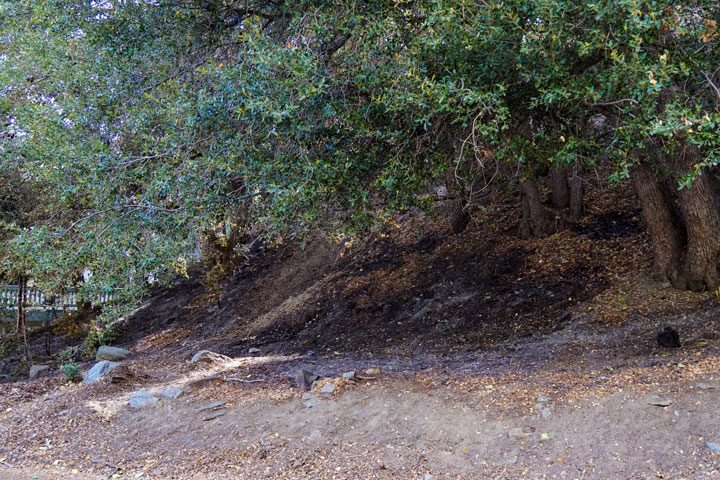
Further west on Lark and then Cardinal, I could see where the fire had crept right down to the road. It was evident that firefighters had been there, as you could see a line scratched out around the burned area to keep it from spreading. From the road, most homes looked as they should—quiet mountain chalets. There was very little evidence that a fire had raged just a few days prior. It is a testament to the firefighters who engaged in structure protection and to the homeowners who were vigilant in their wildfire preparedness.
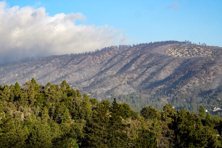
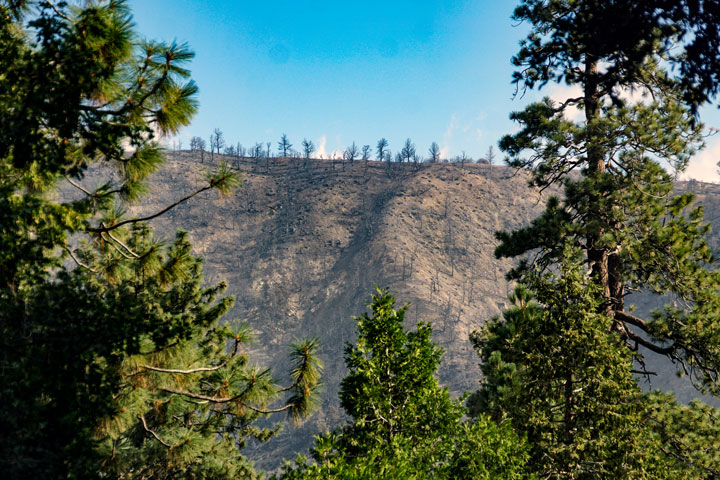
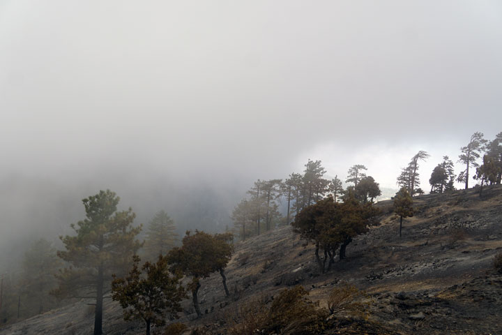
On the north side of Wrightwood, it was a different story. Heading down Cardinal, I could see across the way just how destructive the fire could be. Table Mountain didn’t look like Table Mountain anymore—brush gone, trees just burnt skeletons left behind as a reminder of the forces of nature.
The wind was starting to pick up, the clouds were starting to settle in, and the chill was beginning to bite—a good sign as the fire doesn’t like moisture, but the dry vegetation does. I didn’t travel to any of the homes that burned down. I didn’t want to, didn’t need to. While the majority of homes survived the fire, it is no solace for those who lost their home.
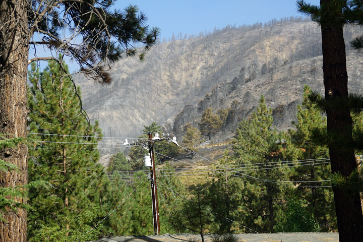
On Highway 2, we’ve all seen the pictures and video as news crews seemed to post up in the areas most affected by the fire, which was mostly west of town from Flume Canyon to past Mountain High. It was odd to see no traffic on Highway 2, just the occasional engine or utility vehicle passing by.
As I stood on the side of the highway just past Flume Canyon, I was pondering how one spot of land had completely burned while a plot adjacent was completely untouched.
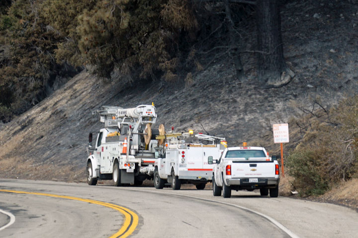
The power lines didn’t fare too well. Most utility poles were burned or nonexistent along the highway. Lines were stretching from one “pole” to another, hung up in a tree or lying on the ground. I was standing across from some power and utility lines that were hanging so low that, had I walked up to them, I could have reached up and grabbed them. They were temporarily tied and pulled to the side of the road to keep from getting in the way. In case you’re wondering, I didn’t walk over and grab the lines. I’m pretty sure they weren’t energized, but I didn’t want to prove my theory.

For the most part, the ziplines are gone, a network of dangling cables and burnt platforms.

Utility trucks were along the highway—Frontier, I believe—looking like they were making plans to restore services.
Further down the road in the Mountain High East parking lot, a row of 12 or so huge utility trucks, complete with cherry pickers and some with chippers attached, were staged and getting ready to head out to cut trees, replace power poles, or something similar. Though, I’m only assuming that was the plan. The bases at Mountain High East and West looked good, but the tops of the hills took the brunt of the fire. Mountain High is still assessing, but making plans to open this winter. They’ll do it, that’s for sure.
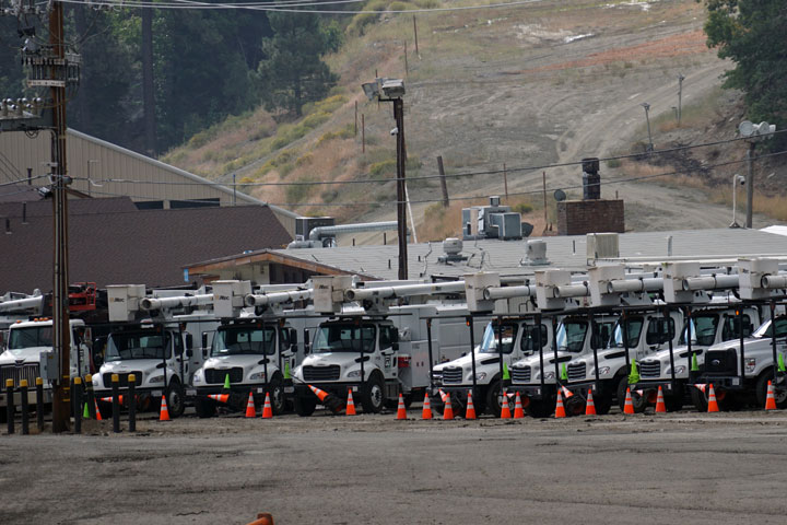
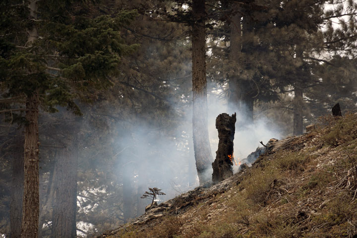
Table Mountain was directly in the path of the fire. The cabins look good; I could see that fire had come right up to and around many of them. On the way up, there were a few tree stumps that were burning and smoking. It’s been almost a week since the fire passed by, and flames are still present. It’s amazing how resilient a fire can be, and it drives home the point that firefighters want to be sure the fire is out before lifting evacuation orders.
Just ahead, at the turnout, I stopped to get a view of Mountain High and the surrounding area. Visibility was down to zero because of smoke, err…clouds—it’s crazy how similar they can look. A week ago, smoke was floating through the canyon, and now it’s filled with moist clouds and cool temperatures from an incoming cold front. I know which I prefer!
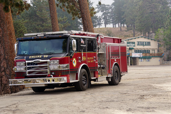
At Mountain High North, it looked like there was a water tender and a few utility vehicles parked, perhaps waiting for orders, or maybe it was a temporary heliport for choppers that were grounded because of visibility and wind. To the side was Engine 88 from Milpitas Fire Department. Thanks, boys, for coming out and assisting on this fire. Actually, thanks to all the firefighters from around the state and beyone who answered the call to action and saved a community.
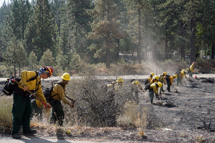
On my return to the village, I came across a crew mopping up, making sure to extinguish even the smallest bit of fire potential. I suspect they were either a CCC crew or a convict crew, maybe even our own Fenner Camp crew. I didn’t ask.
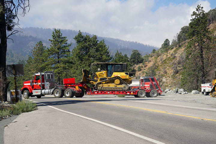
Continuing back through town, it looked like business as usual, except there was nobody on the highway, no one picking up mail, getting gas, or grabbing a bit of hardware or a grocery or two. A few places were open for the first responders and any other folks that might be about, but all in all the Village looked as it did in the days before the Bridge Fire. As I was leaving town, the weather was clearing up a bit. Most of the clouds were over the west end of the canyon, blue skies to the east. Several dozer rigs were sitting at the old dump on Highway 2, some pulling out, no doubt to cut more lines.
At Highway 2 and Highway 138, a CHP officer and a National Guard Humvee were on guard, making sure only the folks who needed to be there were getting in.
Even heading down Sheep Creek Road in Phelan was an odd sight. An empty highschool and middle school. Should I slow to 25 mph or say at 40? Nobody was around, no parked cars along the roadside, no buses, no traffic. Except at the district office, that parking lot was filled more than usual. Much planning is needed for when school resumes, hopefully sooner than later. As I neared Phelan Road it seemed as if I was coming out of a daze. I could see cars and folks were bustling around, business as usual. And you wouldn’t have suspected that even the day before much of Phelan and Pinon Hills was under evacuation order or warning. I pulled into the Stater Bros. parking lot and noticed that there were still a few trailers and campers tucked out of the way. Sheep Creek Water was there with a water truck filling tanks and containers for those that needed it. One thing is for sure in the Tri-Community in times of need we all come together and lend a hand.