Good news for mountain travelers! Caltrans has officially reopened the Angeles Crest Highway (State Route 2) in both directions, restoring the scenic route between Interstate 210 in La Cañada Flintridge and State Route 138 near Wrightwood.
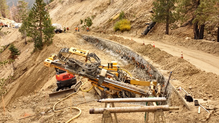
More than 10 miles of the highway had been closed since early 2023 due to relentless storms during the 2022–2023 winter season which caused serious washouts and landslides between Islip Saddle (post mile 64.1) and Vincent Gulch (post mile 74.7). Runoff and slides undermined the roadway and left sections of the guardrail without support, as well as further damage from the Bridge Fire in 2024. Now, after months of work and about $7.9 million in emergency repairs, drivers can once again enjoy one of Southern California’s most beautiful drives.
Caltrans crews rebuilt slopes, installed new guardrails, drainage systems, and retaining walls, and replaced a damaged cable-mesh drapery system designed to catch falling rocks. The completed work not only restored access but also stabilized the roadway to prevent future slope and embankment failures.
A Mountain Road Built Almost a Century Ago
The Angeles Crest Highway has long been part of life in the San Gabriel Mountains, offering Wrightwood residents and visitors a breathtaking passage through the forest.
Construction of the “skyline drive,” as it was first called, began in 1929, but the project wasn’t completed until 1956. The finished route winds roughly 66 miles from La Cañada Flintridge to Wrightwood, climbing above 7,000 feet and offering some of the most spectacular views in the region.
Over the years, storms, rockslides, and wildfires have taken their toll, leading to frequent closures for maintenance and repair, including the latest closure, which took place on Oct. 22nd when Caltrans crews removed large rock falls from SR-39/SR-2 to Forest Service Road 4N56.
Still, the highway remains a beloved gateway for recreation, connecting mountain communities like Wrightwood to the rest of Southern California.
Popular Stops and Landmarks Along the Crest
Whether you’re a first-time visitor or a longtime local, the Angeles Crest Highway offers plenty of worthwhile stops along the way. Here are a few favorites to explore:
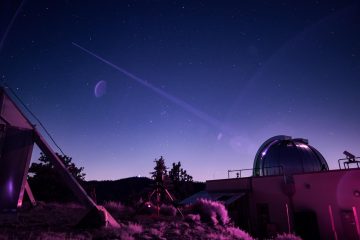
Mount Wilson Observatory – Just off Mount Wilson Road, this historic observatory has been studying the stars since 1904. Visit their website for updated visitor information and public star gazing events. https://www.mtwilson.edu/
Red Box Junction – A popular hub for hikers heading to Mount Disappointment, San Gabriel Peak, or the Mount Lowe Trail. There is a large parking lot, picnic tables, portable toilets and drinking water.
Switzer Falls Trailhead – One of the area’s most beloved hikes, leading to a shaded canyon and a picturesque waterfall.
Islip Saddle – A key trailhead offering access to the Pacific Crest Trail and sweeping views of the Mojave Desert.
Vincent Gap – Near the eastern end of the highway, this high-altitude pass is a favorite starting point for hikers tackling Mount Baden-Powell.
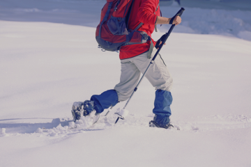
While the Angeles Crest Highway provides access to popular hiking trails, camping sites, and scenic outlooks, visitors are reminded that the Angeles National Forest is now at extreme fire danger levels, with campfires, barbecues, stoves, and all open flames strictly prohibited. Visit the Angeles National Forest website for more updated alerts on fire danger status.