NEWER UPDATE – SEPTEMBER 21, 2020 Evening Update can be found here: “Bobcat Fire (9/21/20) Evening Update; Increased Activity & New Fire Fronts“
NOTE: NewsPlus will plan on posting two updates an AM and PM update to our website and more if needed. Please follow our Facebook page for any timely updates throughout the day.
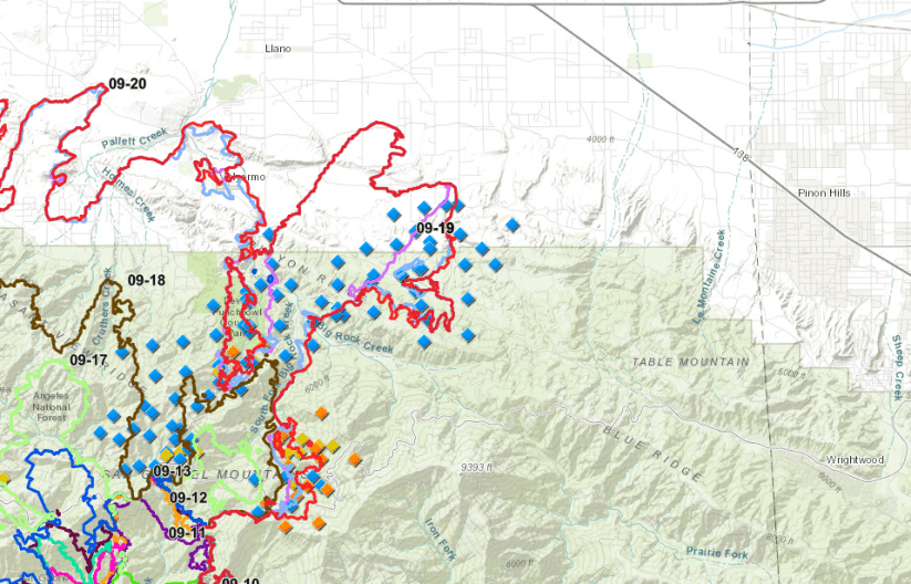
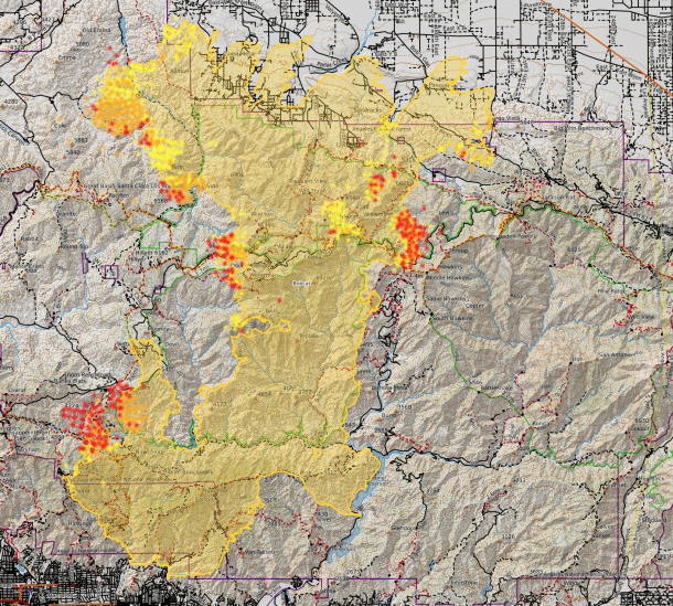
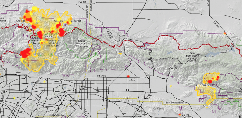
SEPTEMBER 21, 2020 – BOBCAT FIRE Morning UPDATE 10:00 aM: The Bobcat fire has now burned 105,345 acres, burning almost 6,000 acres today and remains at 15% containment.
From Incident Command: “Today on the southern perimeter crews will continue securing line between Mt. Wilson and Highway 2. Defensive strategic firing operations may occur today to slow the growth of the fire. On the northern end of the fire’s perimeter towards Antelope Valley, firefighters are constructing both direct and indirect line to stop the fire from spreading to the east and west. Both hand and dozer line construction continues on the eastern and western flanks. Throughout the fire, additional work continues on holding and improving fireline. Please watch the public meeting tonight live on the Bobcat Fire YouTube Channel: bit.ly/3iQy9zp or steaming from the Los Angeles County Fire Facebook. Representatives from the fire will be on hand to answer questions. American Sign Language interpreters will be live-signing.”
Weather is expected to be cooler than yesterday with low humidity. Winds are expected go be from the east and then in the afternoon, from the south to southeast. Wind gusts are expected between 20 – 30 mph.
So far this morning, air attacks have begun, looks like mostly on the south end of the fire. No helicopters are working on the north end of the fire, yet.

Evacuation Orders:
- Residences along Angeles Crest Highway, between Angeles Forest Highway and Highway 39.
- The unincorporated areas of Juniper Hills, Devils Punch Bowl, and Paradise Springs.
- The unincorporated areas of Crystal Lake, East Fork of the San Gabriel River, and Camp Williams.
- South of Hwy 138, North of Big Rock Creek, East of 87th St East, and West of Largo Vista Rd.
- South of 138th St. East, North of Big Pine Hwy and Hwy 2, East of Largo Vista Rd., and West of 263rd St. East. – South of Hwy 138, North of East Ave W-14, East of 155th St East, and West of 165th St. East. (Clear)
Evacuation Warnings:
- City of Pasadena
- Unincorporated communities of Altadena, Pinon Hills and Wrightwood.
- South of Pearblossom Hwy, East and North of Angeles Forest Hwy, North and West of Mt. Emma Rd., East and South of Hwy 122, and West of Cheseboro Rd.
- South of Hwy 2, North of Blue Ridge Truck Trail, East of Hwy 39, and West of the Los Angeles Co. border.
- South of Ave U-8, North of East Ave W-14, East of 121st East, and West of 155th St East.
- South of Pearblossom Hwy (Hwy 138), South and East of Pearblossom Hwy (Hwy 122), North and West of Mt. Emma Rd., North and East of Angeles Forest Hwy, and West of Cheseboro Rd.
- South of Mt. Emma Rd., North of Upper Big Tujunga Canyon Rd., East of Angeles Forest Highway, and West of Pacifico Mountain.